AZ Transmission Futures
The AZ Transmissions project at Arizona State University uses advanced geospatial technology to map and analyze Arizona’s power infrastructure. A team of students and professionals is extracting data from complex PDFs, georeferencing maps, and automating data extraction using GIS software. The goal is to transform static maps of transmission lines and power stations into interactive, geographically accurate data layers. This project is a proof of concept, showcasing cutting-edge skills while contributing to real-world energy infrastructure planning and analysis.
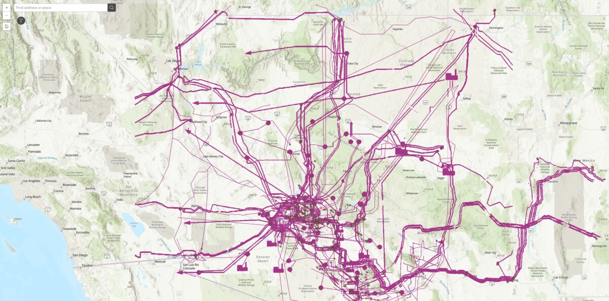
The AZ Transmissions project is an initiative to streamline the mapping and analysis of Arizona’s electrical transmission infrastructure. It involves a team of students and professionals from ASU’s Next Lab working closely to process complex data related to power lines and stations using advanced geospatial technology, such as ArcGIS Pro.
The core objective is to extract detailed information from a series of Integrated Resource Plans (IRPs) and related documents provided by Arizona’s major energy companies. These documents contain maps and technical data vital to understanding and visualizing the state’s power grid. However, this information is often embedded in PDFs, which poses challenges for extracting accurate geospatial data. The project addresses these challenges by employing ArcGIS Pro to georeference these images, meaning the team is transforming static maps into interactive, precise geographic layers that can be analyzed and manipulated.
Key components:
- Data Extraction and Automation: The team is developing scripts to automate map data extraction from PDFs, ensuring that the process is efficient and scalable.
- Georeferencing: The maps from the PDFs need to be accurately aligned with real-world coordinates. Georeferencing is a critical step in this process, allowing the team to overlay the extracted data onto base maps of Arizona.
- Collaboration and Skill Development: The project is an educational experience for the team members, many of whom are students. By working with industry-standard tools like ArcGIS Pro, they are developing valuable skills in the geospatial and energy sectors.
- Case Studies and Proof of Concept: Beyond the technical work, this project is intended to create a proof of concept that could serve as a model for future geospatial projects. The outcome will help with the immediate goal of visualizing Arizona’s transmission infrastructure and demonstrate how geospatial technology can be used to solve complex problems across various sectors.
AZ Transmissions is an exciting example of how academic, technological, and industry collaboration can solve real-world problems. It underscores the importance of geospatial technology in managing critical infrastructure while simultaneously providing hands-on experience to students, preparing them for careers in high-demand fields like geographic information systems (GIS) and energy management.
Creators:
- Kelly Barr
- Hrushikesh Pandit
- Jake Swanson
- Sahil Garg
- Sahil Hadke
Partners:
ASU Next Lab™
Powered by collaboration across ASU’s innovation ecosystem.
Got an idea, project, or question? Connect with Next Lab →